Contact ADSK Solutions for all of the latest insight and devlopments for new Leica 3D laser scanners, software and how this could impact you. 248-906-ADSK (2375)
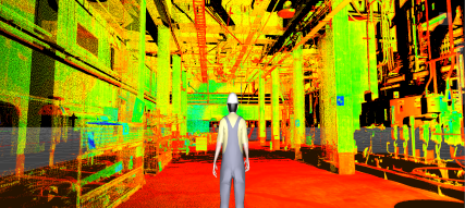
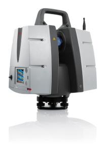
What a great week at the SPAR conference! Leica Geosystems unveiled three new scanners, referred to as the P-Series, the P40, P30, and P16! These scanners have some really great advances for HDS workflows. A few of these outstanding new features are listed below:
- HDR Imaging (no more honeycomb images)
- Scan in the rain and fog (IP54 rating for dust and water resistance)
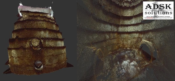
- Incredibly clean point clouds
- Longer range (up to 270m)
- -20 to +50 degrees C
*New firmware for P20 to be released May 1st. You don’t want to miss this upgrade!

NEW STREAMING POINT CLOUDS
Leica Geosystems Announces New JetStream Software for CLOUDWORX, an Ultra-High-Speed Server for Laser Scan Data and Improved Project Data Management Platform. Contact ADSK Solutions today to attend one of our live presentations! info@ADSKsolutions.com
Streaming Laser Scan Data for Big Office Productivity Gains
Instantaneous loading of point cloud data sets of any size. No waiting, no “regens”, and no patchy screen.
Centralized “Project Vault” for Data Management
Leica JetStream Project Vault is a true archive of project data, including point clouds, images, saved clips and layers from Leica Cyclone, and survey control.
Flexible and Affordable Deployment
Affordable deployment options to support their usage needs.
6 MONTH FREE TRIAL
Contact ADSK Solutions Leica Geosystems GOLD dealer for details 248-906-ADSK (2375) – ADSKsolutions.com
New CLOUDWORX for Autodesk NAVIVISWORKS (NAVISWORX)
This new plug-in from Leica enables complete workflows for BIM. Building Information Modeling (BIM) is changing how buildings, infrastructure, and utilities are planned, designed, built, and managed. BIM for existing structures are captured with 3D laser scanners for providing as-built conditions in brilliant fidelity. Millions of photo realistic, accurate measurements can be acquired in seconds and they turn information into insight and deliver business value at every step in the process. Now with the new version of Cloudworx for Navisworks (NAVISWORX) points clouds can be seamlessly intergrated into the entire design process utilizing there native format.

NEW LEICA GLOBAL TRUEVIEW
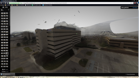
Leica Geosystems announces TruView Global TruViews are now accessible via any Internet browser, on any device, without a plug-in.
TruView Global, TruViews are now a viable deliverable to any client. Users will find all the same important, popular, and familiar TruView capabilities such as zoom, pan, measurement/mark-up, geotags, and navigation between scan locations, with added and improved offerings including mark-ups being centrally stored for immediate visibility across project partners/concurrent users. This creates a better collaborative environment with easier information sharing between stakeholders.

TruView Global is also backwards compatible. All existing and previous TruViews can be imported and updated to the new TruView Global server format for improved access and collaboration—simply upload existing or new project data to the TruView Global server. Re-energising old projects with TruView Global offers end-users new capabilities from legacy data. All TruView Global point cloud views, from legacy or new data, will continue to take advantage of the “free for use” business model, allowing free access and viewing to end-users.
Lots of changes and more to come. Point clouds are becoming more and more common. Have you seen the hand scanners that are available? It’s time to take advanage of 3D laser scanning technology. Contact ADSK Solutions today for your complimentary presentation of scanning and crucial software workflows and solutions. I have been working with 3D laser scanners since 1998 and utilized the first 3D scanner Cyrax 2400 (now Leica) that was released for production use. I actually have it in my office and yes it still works!
TechKNOWLEDGEy is continously evolving; are you?
-info@ADSKsolutions.com-

Chad Studer
Owner/President
ADSK Solutions, LLC
ADSKsolutions.com
Troy, MI
42.556600
-83.160182


 360,000 points a second
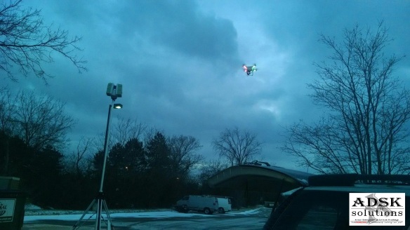
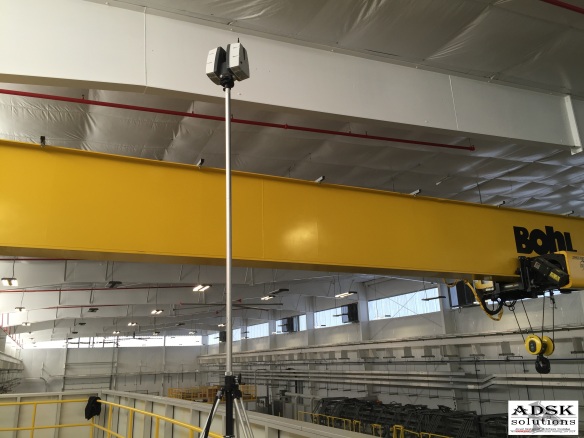 ADSK Solutions has elevated their rental pool. We have P40, P30, P20, C10, 7000 and other scanners available upon request. We aim to always have equipment available for rentals; if we don’t we will help you find what you are looking for. RESERVE – CAPTURE – RETURN. Targets, target poles, elevated and inverted tri-pods available, and other scanning supplies are also available along with your scanner rentals. ADSK even offers UAV rentals upon request.